Home / Products
Loss control & insurance products
Underwriting, risk surveys and claims are three points on the same cycle. These platforms connect them: what a claim reveals sharpens the next survey and the next premium.
UNDERWRITING · WILDFIRE
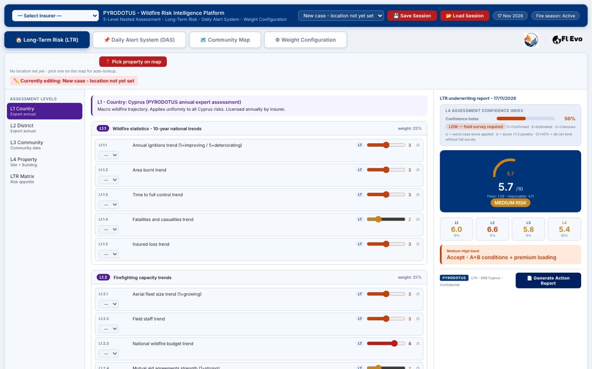
PYRODOTUS wildfire risk intelligence
Long-term wildfire risk for every insured property, a daily fire weather alert system and community maps. Built for Cyprus and endorsed by the Cyprus Department of Forests.
- Long-term risk. Country, district, community and property levels; 74 property factors with a confidence index and a printable risk action report.
- Daily alert system. Seven-day fire weather outlook per insured location, Canadian Fire Weather Index chain.
- Community map. Settlement-level risk for portfolio accumulation.
- Weights from real losses. The factors are calibrated on reconstructed fires, not on assumptions.
FOR: INSURERS · REINSURERS · BROKERS
LOSS CONTROL · INDUSTRIAL
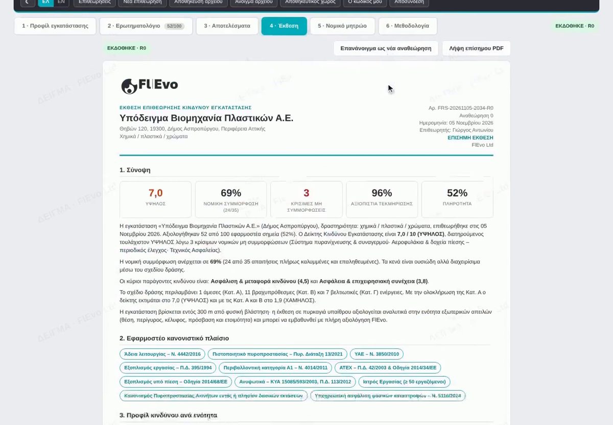
Facility risk survey and digital inspection
From the site visit to the signed report in one platform: facility profile, external threats, questionnaire with legal references, photo evidence stamped with place, time and inspector, scoring, report and legal register.
- Risk index and legal compliance scored per section, with critical findings flagged.
- Evidence you can defend. Photos and notes sealed with place, time and inspector.
- Natural hazard exposure built in. Distance to natural vegetation, flood exposure and neighbouring activities.
- Works in the field on a phone, encrypted on the device.
FOR: INSURERS’ RISK ENGINEERS · LOSS CONTROL CONSULTANTS · INDUSTRIAL OPERATORS
CLAIMS · POST-LOSS
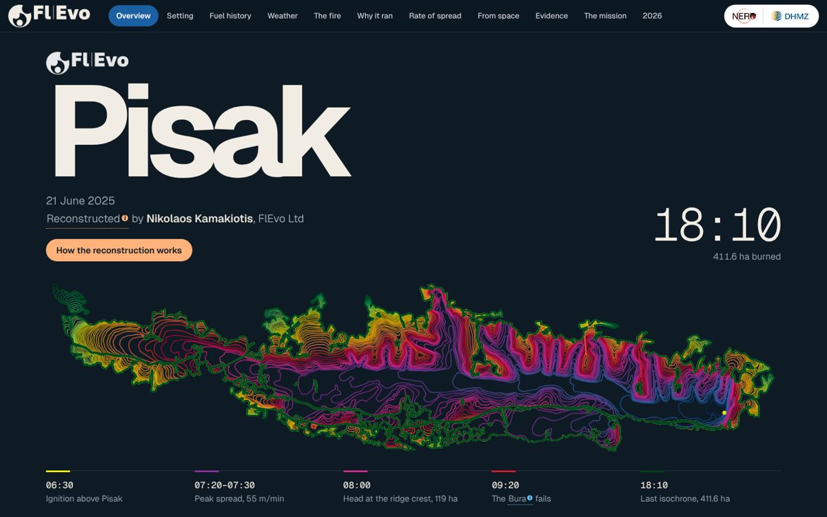
Digital fire history
A forensic reconstruction of a real wildfire, delivered as an interactive report: when the front reached each property, from which direction and under what wind, tied to dated evidence.
- Arrival-time maps in ten-minute steps over 3D terrain.
- Evidence register of every photo, video, webcam frame and satellite detection used.
- Fire behaviour analysis of the wind, terrain and fuel mechanisms.
- Feeds underwriting. Every reconstruction sharpens the PYRODOTUS weights.
FOR: CLAIMS AND LOSS ADJUSTERS · INSURERS · AUTHORITIES
See them on your own portfolio.
Demonstrations for insurers, brokers, risk engineers and loss adjusters, in Greek or English.