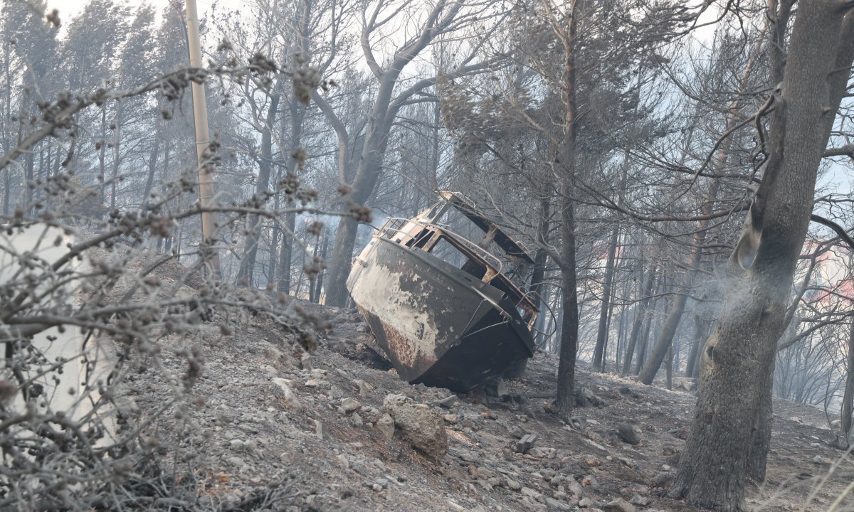
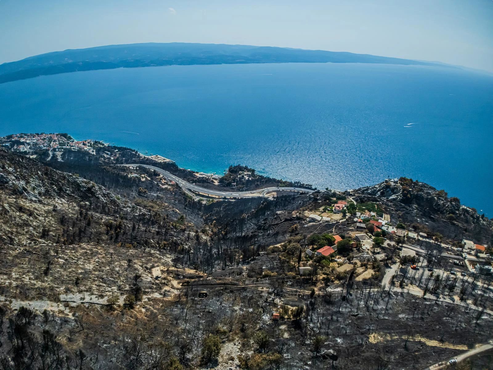
Pisak lies on the narrow coastal strip between Omiš and Makarska. Two DHMZ automatic weather stations bracket it: Split-Marjan, about 35 km to the north-west, and Makarska, about 19 km to the south-east. Fire brigade monitoring cameras at Nerežišća on Brač, Brela, Cista Provo and Vela Straža watched the coast.
The fire burned a strip 6.1 km long and up to 1.4 km deep, from the ridge down to the sea, through Pisak, Marušići and Medići towards Mimice. Unburned houses, plots and roads inside it are cut out of the burned area.
The slope rises from the sea to over 600 m in little more than a kilometre and is cut by gullies running from the crest to the coast (red). East of Pisak the crest drops from over 600 m to about 300 m: the lowest gap in this section of the ridge.
The Habsburg cadastral survey of 1834 maps the slope as farmland: vineyards, olive groves and pasture around the villages, georeferenced here over today's terrain.
Vineyards (magenta) covered about 125 ha, 93 ha of them inside what would become the 2025 burn scar.
Aerial imagery from 1968 shows natural tree vegetation confined to about 25 ha of scattered stands, 20 ha of them within the later scar.
By 2025 natural tree vegetation, largely Aleppo pine, covered 167 ha, 144 ha of it inside the burn scar: seven times the 1968 cover. Cultivation had shrunk to 15 ha of olive groves and a few small vineyards. Abandoned terraces had become continuous fuel from the ridge down to the houses.
The slope had burned before. Fires in 2014 (3.6 ha, above Pisak) and 2018 (14.2 ha, mostly inside the later scar) burned patches of it. A 207 ha fire in 2015 burned immediately to the west (orange); the 2025 fire stopped about 400 m short of it.
After a hot, dry June (Fire Weather Index at Makarska 44.7 on the day), cold, dry air over the continental interior spilled south-westward over the Dinaric coastal ridge and down to the Adriatic overnight (blue streamlines). The Bura peaked at Makarska at 03:50: 16 m/s, gusts 29.4 m/s. At ignition, 06:30, it was still 13.7 m/s with gusts of 26.5 m/s, and relative humidity was close to 12 %.
The direction hardly changed for more than nine hours: NNE to NE at Makarska, NE at Split-Marjan, until the Bura collapsed at 09:20.
Streamlines are schematic. Wind roses and dials: DHMZ automatic stations, 10-minute data; dials point the way the wind blows. Synoptic analysis: DHMZ.Fire starts above state road DC8 in Pisak. It is reported at 06:36; crews from Omiš, Brela and Baška Voda are dispatched.
Ten minutes in, the fire brigade camera at Brela, 7 km to the south-east, records smoke lying low along the slope above Pisak.
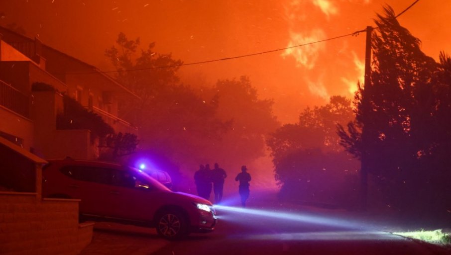
The head has turned west along the slope, parallel to the coast. At 07:15 fire crosses DC8 in Pisak and burns between the houses; the road is closed a minute later.
The fastest ten minutes of the day: between 07:20 and 07:30 the head advances 552 m, 55 m/min. At 07:33 Brela shows open flame on the slope above Pisak.
A firefighter photographs DC8 in heavy smoke with flames on the slope. The phone record fixes the time: 21 June 2025, 07:40.
From 07:41 the fire brigade camera at Nerežišća on Brač, 22 km across the channel, records the slope every 20 to 40 seconds. Scroll slowly: the frames run with the clock.
Smoke is held in a horizontal band and pushed west. A dense column breaks upward on the right of the frame, then a second: the slope fire and a separate coastal tongue, burning as two fronts.
Four to five convective cells rise at regular spacing across the burning slope. Above them the smoke flattens and spreads west.
A single dominant column penetrates the smoke ceiling, narrow at its base and expanding above. Below it, smoke keeps moving west at low level.
A second, larger column develops, further west than the first: the head has moved.
From Cista Provo, inland to the north, the plume rises over the ridge at the same minute.
The Zagon camera sees the plume streaming out over the sea to the west. By 08:00 the head has run 3.7 km in 90 minutes and reached the ridge crest; 119 ha have burned.
The Nerežišća frames place the head near Medići. Residents and tourists in Marušići have been evacuated in heavy smoke since 08:02.
The key record of the day. A private security camera in Medići, running on its own clock, shows smoke closing in at 08:13 and flames entering the yard within a minute. It fixes the arrival of the front at a known point to the second.
From Nerežišća the front is now above Mimice. At 08:21 turbulence keeps the Canadair from approaching.
The Brela camera records a water drop on the front above Pisak. By 08:46 turbulence forces the Canadairs to withdraw to Divulje.
The front reaches Mimice. The head has slowed to 14 m/min, against 50 m/min an hour earlier.
The last Nerežišća frame. Smoke lies along the whole coast; the head is moving at under 10 m/min. 242 ha have burned.
At Makarska the north-easterly collapses and turns into a light south-westerly. The run is over: from here the fire spreads slowly, by flanks and reactivations. 269 ha have burned.
316 ha, 77 % of the final area, burned in the first three and a half hours.
The western edge creeps towards Lokva Rogoznica at 1 to 2 m/min. Reactivations keep reaching houses in Medići. 376 ha.
The last isochrone closes the burned area at 411.6 ha.
Measured along the path of the head (white), the fire covered 3.7 km in its first 90 minutes, at 35 to 55 m/min, and reached the ridge crest by 08:00. After that it slowed to under 20 m/min, and after the Bura failed at 09:20 to a few metres a minute.
Rate of spread between successive isochrone crossings of the spread path.1 · Oblique deflection
The Bura met the ridge at an angle and was deflected west, parallel to the sea front. That is why the burned area is a long blade along the coast, not a fan down to the sea.
2 · Up the gullies, against the wind
With the Bura blowing down the slope, the fire still ran up the gullies to the crest, ahead of the main front. The gullies acted as chimneys and left the finger-shaped northern edge of the burned area.
3 · Rotors on the lee slope
Below the crest the Bura broke into rolling eddies. Where they touched the ground the fire surged, in regularly spaced cells.
4 · A lid over the slope
A stable layer near 500 m held the smoke and heat down and pushed the fire sideways. Columns broke through it several times.
The Nerežišća camera frames, looping: smoke held under a flat ceiling, then a column breaking through it.
5 · The gap east of Pisak
East of Pisak the ridge drops from over 600 m to about 300 m. The Bura was funnelled through this gap, faster and drier, onto the slope above the village.